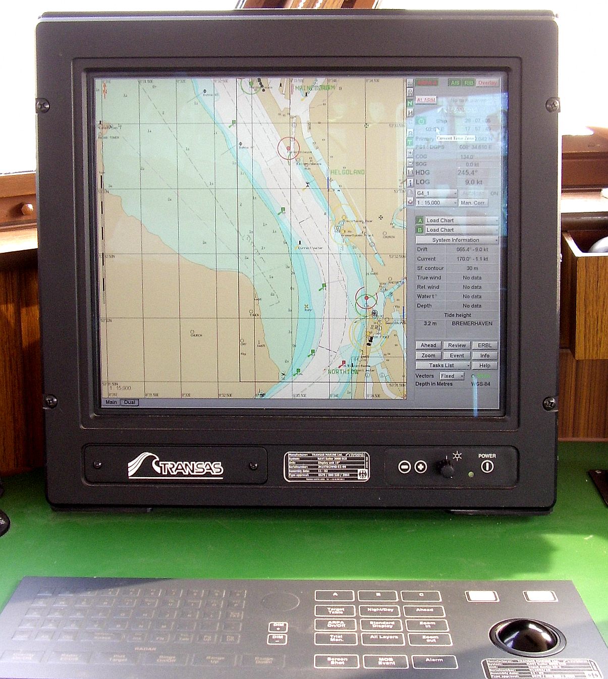
The nautical chart is the most information-dense document aboard — a century-deep language of symbols, soundings, depth contours, cautionary notes, and traffic schemes compressed into a single visual surface. Reading it correctly is a trained skill; an AI that can read it is a different kind of tool — one that can answer 'what's the depth here', 'what does that symbol mean', 'what hazards does this passage cross' against the chart itself.
Chart interpretation is a vision-and-symbol problem — the model must read the structured language, not just the image — and it's the key that unlocks chart-based AI assistance.
Key findings
- The chart is a symbol language — every mark encodes a navigational fact; reading it is interpretation, not OCR. Established
- ECDIS vector data is machine-readable — the structured form (S-57/S-101) is the AI-friendly input, not the raster image. Established
- The AI's role is the query layer — 'what's the depth', 'what does this symbol mean', 'what hazards lie on this track'. Research demonstration
- Raster-chart interpretation (paper-chart image understanding) is the harder problem — the symbology read as pixels. Research demonstration
- The safety-critical constraint is accuracy — a misread depth or symbol is a navigational error, not a text error. Established
The chart as a language
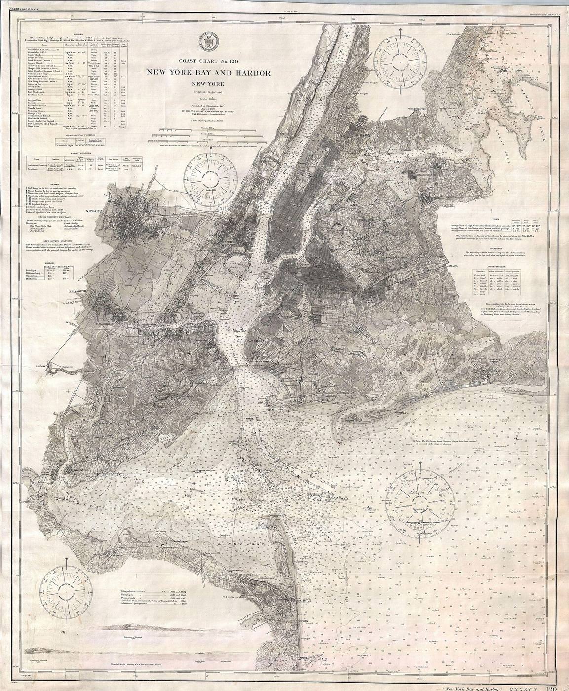
The chart encodes a century of hydrographic practice in its symbology — the depth contour's meaning, the wreck marker's specificity, the caution note's legal weight. Reading it is not image recognition; it's reading a compressed technical language where every glyph is a fact. An AI that 'sees' the chart without understanding the code is a camera, not an interpreter — and the difference between them is whether the model can answer a question the navigator would ask. Established
Vector vs raster
- <strong>Vector (ECDIS).</strong> The S-57/S-101 data is structured — the depths, objects, and attributes are machine-readable fields. The AI queries the data, not the image. Established
- <strong>Raster (paper-scan).</strong> The chart as image — the symbols are pixels that must be recognized and interpreted. The harder, research-level problem. Research demonstration
- <strong>The honest architecture.</strong> Query the vector data where it exists; use image interpretation only where it doesn't. Maritime-GPT analysis
What the AI can answer
The useful chart-AI is a query layer — 'what's the controlling depth on this track', 'what does this symbol denote', 'what cautions apply to this approach', 'does this passage cross a restricted area' — answered against the chart's actual data rather than the model's memory of what charts usually contain. The value is speed and coverage: the navigator's question answered in seconds with the clause cited, rather than a manual lookup through a legend. Research demonstration
The accuracy constraint
A misread chart is a navigational hazard — 'the depth is 15m' when it's 5m is a grounding, not a typo. The chart-interpretation AI's output must carry the same verification discipline as the compliance copilot's: cited to the chart's actual data, the symbol read against the official legend, and 'I can't read this symbol' as a valid answer. The chart is safety-critical data; the AI that interprets it must be as careful as the navigator reading it. Established
What we know
- The chart is a symbol language — interpretation, not OCR.
- Vector ECDIS data is the machine-readable form; raster interpretation is harder.
- The AI's role is the query layer, not the primary chart reader.
What we don't
- Whether chart interpretation can be certified for passage-planning assistance.
- Raster-chart symbol recognition rates at operational accuracy.
- How chart-AI integrates with ECDIS-standard data models.
Being tested
- Vector-chart query interfaces for navigators.
- Raster-chart symbol recognition on historical and paper charts.
- Passage-planning assistants grounded in chart data.
Maritime-GPT analysis
Chart interpretation is the AI's literacy test — the chart is a dense technical language, and the model that can read it is genuinely useful; the one that only describes the image is a screenshot captioner. The honest product queries the vector data where it exists and admits where it can't — because a misread sounding is a grounding, not a quirk. The chart-AI's value is the navigator's question answered against the actual chart, cited to the symbol. Maritime-GPT analysis
This is a research feature, not operational guidance. Simulation results are reported as simulation; demonstrations are not deployments; company claims are attributed as such. Verify safety-critical decisions against official nautical publications and flag-state requirements.